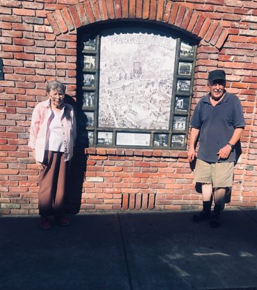
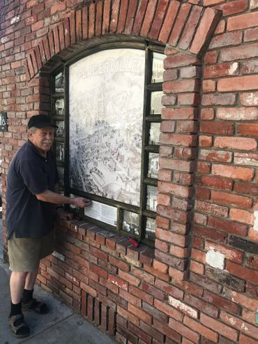
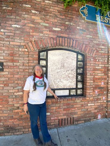
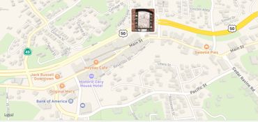
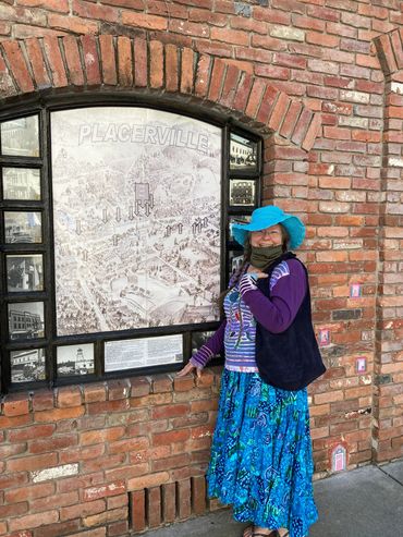
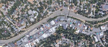
Tour Starts Here at 477 Main Street, Placerville, CaliforniaThe old 1888 map is a bird’s-eye view of Placerville, California by The Weekly Observer

Old City Hall Lot, Main Street, Placerville, California


Step back in time and uncover the captivating history of Placerville. Our self-guided walking tour invites you to explore the town's gold rush past and vibrant community life. Visit our website today to plan your historical adventure and immerse yourself in California's rich heritage! #ExplorePlacerville #GoldRushHistory #AdventureAwaits #TouristAttraction #Self-Giuded #WalkingTour

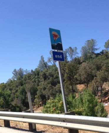
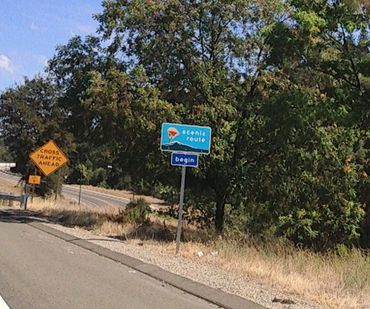
At the crossroads of U.S. Route 50, a designated scenic highway in the Golden State—home of California Poppy, our state flower—and California State Route 49, historic 300-mile drive through California’s Gold Country, Placerville stands as a gateway to the rich heritage of the Sierra foothills and the enduring legacy and link in the chain of gold rush towns, a place where the past and present meet along this historic pathway.
"Old 1888 Map & Photo Walk" of Historic Main St. Since 1998. A Gold Rush Mining Camp Named Hangtown, Dry Diggin's and Originally: Ravine City
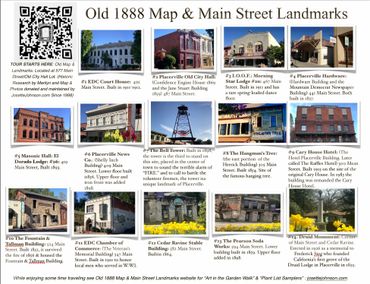
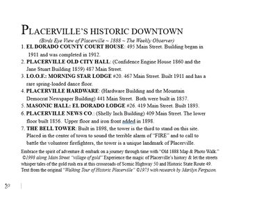
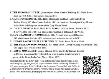


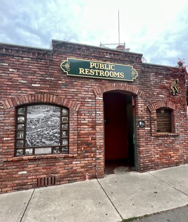
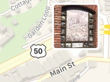
Walk Old Hangtown Tour Starts Here at Old 1888 Map & Photo Walk Display Since 1998 Placerville, California


Old Map & Photo Walk Display Located at Old City Hall Lot
El Dorado County Court House

Located at #1 495 Main Street, this building, a notable Gold Rush landmark, started construction in 1911 and was completed in 1912. Visitors can explore Placerville history through the Old Map and Photo Walk as part of a Self-Guided Walking Tour, making it a must-see gold rush landmarks tourist attraction.
Placerville Old City Hall

Experience Placerville history by visiting the Confidence Engine House, built in 1860, and the historic Jane Stuart Building from 1859, located at 487 Main Street. These Gold Rush landmarks are highlighted in our Old Map and Photo Walk tourist attraction , making them a must-see on your self-guided walking tour of local tourist attractions.
I.O.O.F.: Morning Star Lodge #20

#3. 467 Main Street, a notable example of Placerville history, was built in 1911 and features a rare spring-loaded dance floor. This site is among the fascinating Gold Rush landmarks that can be explored on the Self-Guided Walking Tour, which is a highlight of the Old Map and Photo Walk, attracting many visitors as a key Tourist Attraction.
Placerville Hardware
Placerville News Co.: (Shelly Inch Building)
#4 (Hardware Building and the Mountain Democrat Newspaper Building) 441 Main Street are notable Gold Rush landmarks, both constructed in 1857. These sites feature prominently in Placerville history and are highlights of the Old Map and Photo Walk, making them a must-see on your Self-Guided Walking Tour of this charming tourist attraction.
Masonic Hall/El Dorado Lodge #26
Placerville News Co.: (Shelly Inch Building)
Placerville News Co.: (Shelly Inch Building)
#5. 419 Main Street. Built in 1893, this site is one of the notable Gold Rush landmarks and a highlight for those exploring Placerville history. It serves as a significant stop on the Old Map and Photo Walk, making it an essential part of your Self-Guided Walking Tour or tourist attraction itinerary.
Placerville News Co.: (Shelly Inch Building)
Placerville News Co.: (Shelly Inch Building)
Placerville News Co.: (Shelly Inch Building)
#6. 409 Main Street is a notable Tourist Attraction in Placerville history, featuring a lower floor built in 1856 and an upper floor with an iron front added in 1898. This site is part of the Gold Rush landmarks and can be explored further through an Old Map and Photo Walk or a Self-Guided Walking Tour.
The Hangman's Tree
Located at #1 495 Main Street, this building, a notable Gold Rush landmark, started construction in 1911 and was completed in 1912. Visitors can explore Placerville history through the Old Map and Photo Walk as part of a Self-Guided Walking Tour, making it a must-see gold rush landmarks tourist attraction.
Cary House Hotel

Experience Placerville history by visiting the Confidence Engine House, built in 1860, and the historic Jane Stuart Building from 1859, located at 487 Main Street. These Gold Rush landmarks are highlighted in our Old Map and Photo Walk tourist attraction , making them a must-see on your self-guided walking tour of local tourist attractions.
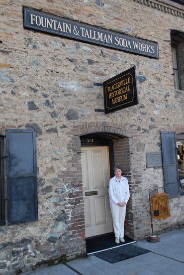
The Fountain & Tallman Building
The Fountain & Tallman Building
#3. 467 Main Street, a notable example of Placerville history, was built in 1911 and features a rare spring-loaded dance floor. This site is among the fascinating Gold Rush landmarks that can be explored on the Self-Guided Walking Tour, which is a highlight of the Old Map and Photo Walk, attracting many visitors as a key Tourist Attraction.
EDC Chamber of Commerce
The Fountain & Tallman Building
#4 (Hardware Building and the Mountain Democrat Newspaper Building) 441 Main Street are notable Gold Rush landmarks, both constructed in 1857. These sites feature prominently in Placerville history and are highlights of the Old Map and Photo Walk, making them a must-see on your Self-Guided Walking Tour of this charming tourist attraction.
Cedar Ravine Stable Building
#5. 419 Main Street. Built in 1893, this site is one of the notable Gold Rush landmarks and a highlight for those exploring Placerville history. It serves as a significant stop on the Old Map and Photo Walk, making it an essential part of your Self-Guided Walking Tour or tourist attraction itinerary.
Pearson Soda Works Building

#6. 409 Main Street is a notable Tourist Attraction in Placerville history, featuring a lower floor built in 1856 and an upper floor with an iron front added in 1898. This site is part of the Gold Rush landmarks and can be explored further through an Old Map and Photo Walk or a Self-Guided Walking Tour.
The Bell Tower

Located at #1 495 Main Street, this building, a notable Gold Rush landmark, started construction in 1911 and was completed in 1912. Visitors can explore Placerville history through the Old Map and Photo Walk as part of a Self-Guided Walking Tour, making it a must-see gold rush landmarks tourist attraction.
Druid Monument
Experience Placerville history by visiting the Confidence Engine House, built in 1860, and the historic Jane Stuart Building from 1859, located at 487 Main Street. These Gold Rush landmarks are highlighted in our Old Map and Photo Walk tourist attraction , making them a must-see on your self-guided walking tour of local tourist attractions.
Old 1888 Map & Photo Walk Display of Main St by Marilyn Ferguson and Josette Johnson Since 1998
Old 1888 Map & Photo Walk Display of Main St by Marilyn Ferguson and Josette Johnson Since 1998
#3. 467 Main Street, a notable example of Placerville history, was built in 1911 and features a rare spring-loaded dance floor. This site is among the fascinating Gold Rush landmarks that can be explored on the Self-Guided Walking Tour, which is a highlight of the Old Map and Photo Walk, attracting many visitors as a key Tourist Attraction.

Embark on a journey through time “Old Map & Photo Walk”©1998
The Old Map and Photo Walk in Old Placerville is a captivating journey through the city's history.
Embrace the spirit of adventure and embark on a journey through time with the Old Map and Photo Walk. This engaging self-guided walking tour along Main Street, known as the "village of gold," invites you to walk through Old Hangtown and experience the rich Placerville history. Here, the streets whisper tales of the Gold Rush era at the crossroads of Scenic Highway 50 and Historic State Route 49. Text from the original "Walking Tour of Historic Placerville" ©1973 features historic research by Marilyn Ferguson.
The tourist attraction walking tour begins here for the history buff—simply scan the code and enjoy a captivating time travel experience in our vibrant city. Check the web portal for the sesquicentennial edition, which celebrates Placerville’s 150 years of golden past, ©2007, highlighting essential gold Rush landmarks, a plant list sampler, public gardens, and mural projects. The Historic 1888 Map and Main Street Landmarks Photo Display, maintained since 1998 and featuring photographs by Archives.JosetteJohnson.com, adds to the experience.
PLACERVILLE
"A VILLAGE OF GOLD"
By: Marilyn Ferguson
Since the first deposits of placer gold were discovered on the banks of Hangtown Creek in 1848, Placerville has been the epicenter of activity in California’s "Central Mines." Miners from all over the world, including Georgians, Chileans, and Sonorans, flocked to Placerville, bringing with them knowledge of mining techniques. While some 49'ers returned home rich from their pursuits, others became the founding fathers of the community, and sadly, some met a more tragic fate, lost to their loved ones.
In 1850, the village was named Placerville, a nod to the significant placer gold deposits uncovered here. By May 1854, it was officially incorporated. In just five years, Placerville transformed from a mining camp into a bustling village, and by popular vote in 1857, it became the county seat.
The name "Hangtown" was born in 1849 when a large oak tree was used to dispense swift justice to wrongdoers, a nickname that has endured and remains part of the charm for some, while a source of discomfort for others.
Placerville's strategic location along the early emigrant route established it as a vital supply center. Following the discovery of Nevada's Comstock Lode silver deposits in 1859, long lines of supply wagons traversed the Sierra Nevada, transporting necessary provisions and returning with precious ore for the Mint in San Francisco.
Many miners thrived, seizing opportunities to open businesses, provide goods and services, and develop a robust lumber industry. They also invested in extensive water and road systems, leading to the establishment of vast agricultural lands.
Today, at the intersection of State Highway 50 and State Route 49, modern Main Street reflects a busy, thriving town, veiled in history. Beneath the modern façade, historic rhyolite stone buildings (circa 1853-1858) stand as testaments to the foresight and dedication of the citizens who helped forge a lasting legacy of this remarkable city.
Originally Published in 2007 © Placerville Sesquicentennial Historic Garden Walk.
Old 1888 Map and Photo Walk of historic Main Street oldest building and points of interest landmarks
For more information on the special edition sesquicentennial book, Historic Garden Walk from 2007 celebrating Placerville’s 150-year golden past with more landmarks & public art at gardens, click below.
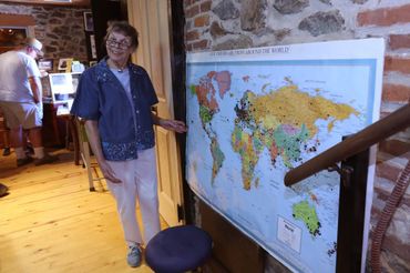
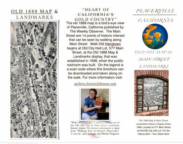
The Old Map and Photo Walk in Placerville is a captivating journey through the city's history. It features an 1888 Birds Eye View map, rendering from an earlier 1851 map, published in "Weekly Observer," offering intricate details of the city's streets and structures. Historic researcher Marilyn Ferguson identified and created a legend for the 12 oldest Main Street buildings, complemented by directional landmarks, the Druid monument torch and the bell tower landmark.
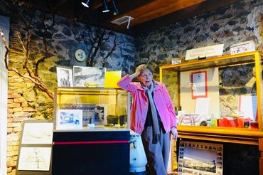
Josette Johnson digitized the map and took photographs of these historic sites, providing a visual connection to the past. The display is thoughtfully located near the old city clock, in a special alcove of the public restroom designed for its preservation, and courtesy of Keith Johnson's help, donation and dedication over the past 25 years. This display is a cherished educational and cultural asset for Placerville, inviting visitors to embark on a journey through time. It's not only a historical resource but also an artistic and cultural treasure that resonates with the city's gold rush era. Whether you're a local or a tourist, this display offers a unique opportunity to explore Placerville's history and its picturesque spots.
From its bronze paint to the photos she captures, preserving the plaque's integrity ensures that this display remains a cherished piece of Placerville's history and to the display's enduring significance and this well-maintained exhibit remains a vital part of Placerville's heritage. It's a must-visit for history enthusiasts, serving as the starting point for a tour of Placerville's, the heart of California’s gold country & mother load is located at the crossroads of Scenic Highway 50 and Historic State Route 49. Simply scan the code to begin your time-traveling adventure and download the old map photo walk brochure for a deeper dive into Placerville's fascinating history.
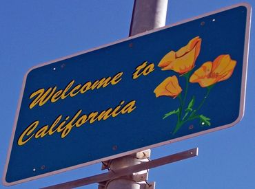
Wildflowers we seeded along the Scenic Corridor of Hwy 50.

The Golden State of California
The state flower is the California Golden Poppy, and Placerville is a notable part of Gold Country, linked in the chain of Gold Rush landmarks along the Golden Highway of Route 49 and El Dorado Highway 50, nestled in the scenic corridor of the Mother Lode. The display itself is located near the old city clock at the public restroom, which
The state flower is the California Golden Poppy, and Placerville is a notable part of Gold Country, linked in the chain of Gold Rush landmarks along the Golden Highway of Route 49 and El Dorado Highway 50, nestled in the scenic corridor of the Mother Lode. The display itself is located near the old city clock at the public restroom, which was designed to accommodate it. Keith contributed by installing a bronzed wood plaque to hold the map, while Josette has diligently maintained this valuable tourist attraction for 25 years. She has even updated the map and photos periodically, with the latest map being a gift from Keith in recognition of her dedication. This display serves as an invaluable asset for Placerville history, providing educational, artistic, historical, and cultural significance to the city. Visitors are drawn to it, reading the Old Map and Photo Walk and downloading it to their phones. The self-guided walking tour offers a unique opportunity to explore Placerville's oldest historic buildings and picturesque spots, making it a valuable resource for both locals and tourists interested in the area's rich Gold Rush era.
River of Gold
Golden Poppies are blooming along the Scenic Corridor of US 50, marking the Historic State Route 49 crossroads from Bedford Ave to the Welcome Sign area in Placerville, known for its rich Gold Rush landmarks. Share your photos from the Old Map and Photo Walk through Old Placerville history. Delve into the fascinating history of Placervill
Golden Poppies are blooming along the Scenic Corridor of US 50, marking the Historic State Route 49 crossroads from Bedford Ave to the Welcome Sign area in Placerville, known for its rich Gold Rush landmarks. Share your photos from the Old Map and Photo Walk through Old Placerville history. Delve into the fascinating history of Placerville through the exhibit titled “Bird's Eye View Placerville, Cal. Published By The 'Weekly Observer' 1888,” available at Stanford Libraries. This historic map showcases a rare view of Placerville, California, positioned in the heart of California's Gold Country, sketched by L. Roethe in 1851. It features a detailed layout of this significant early California mining town, illustrating buildings, street names, and important topographical details. This view is one of the earliest large-format printed representations of Placerville and is quite rare on the market. The map includes 25 insets of notable buildings and residences, alongside a smaller depiction of Placerville in 1851. An index identifies 30 locations and includes a narrative celebrating Placerville's history and El Dorado County's significance. Mining areas are depicted in the surrounding hills, providing a compelling glimpse into the past through this interesting birdseye view by W. W. Elliott, known for publishing some of the most rare Illustrated California County histories, enriched with maps and views of local buildings. The map covers regions of California and the Western US. Both the historic context and the map's significance contribute to the display's overall historical value, making it a great highlight for any Self-Guided Walking Tour or Tourist Attraction.
Placerville Petals
Placerville Petals
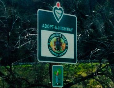
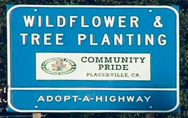
"Volunteers are the Flowers of Placerville." ~ Marilyn Ferguson (with Suzy & Josette) planting poppy seeds near Bedford Avenue, across the creek from where our Self-Guided Walking Tour of Gold Rush landmarks begins at Old City Hall. This effort is part of our Caltrans Adopt-A-Highway Poppy and Pollinators Project, showcasing the rich Plac
"Volunteers are the Flowers of Placerville." ~ Marilyn Ferguson (with Suzy & Josette) planting poppy seeds near Bedford Avenue, across the creek from where our Self-Guided Walking Tour of Gold Rush landmarks begins at Old City Hall. This effort is part of our Caltrans Adopt-A-Highway Poppy and Pollinators Project, showcasing the rich Placerville history to all visitors. Don't miss this opportunity to enjoy a unique Old Map and Photo Walk as a memorable tourist attraction.
Walk Old Hangtown and California Poppy Project Placerville Petals Photo Montage